
Why would you use digital mapping?
Utilising digital mapping has several different implementations in digital humanities. It is most often used as a means of data visualisation, but often has its benefits in digitising historical and cultural maps from physical formats and georeferencing locational data. With the recent years of the COVID-19 pandemic, digital mapping has become a vital tool in not only analysing COVID case numbers and tracking transmission, but also as a method to understand how cultural forms of health and resource management have adapted themselves into the digital world. Caquard et. al (2019) for example, make note of Mappingback, an “Indigenous Cartographies of Extractive Industries”, highlighting how digital mapping can be utilised in a context that is mainly revolved around social justice, allowing users and indigenous communities to visualise resource and land conflicts. In this regard, having a general sense and understanding of how digital mapping works firsthand is crucial in navigating our post-colonial landscape, as well as seeing how non-digital formats can be digitised.
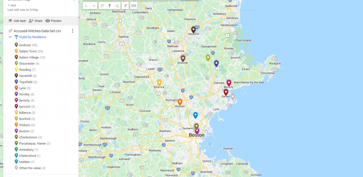
The initial decision to utilise Google My Maps as a digital mapping tool was as a continuation of a mapping exercise we as a class worked through a few weeks ago. The appeal of Google My Maps would be the familiarity and the relative accessibility of the mapping tool. By accessibility, I mean to say that Google is already quite well known and accepted as an online with its many functions and applications. As The Economist (2017) asserts, more than 1 billion people utilise Google maps each month; having a name that is widely recognised within the realm of digital humanities lends itself to wider appeal and potentially reaching wider audiences. The existing use of My Maps is primarily to plot personal data points and create custom maps that allows for searching, drawing and personalisation of maps. However, as per the digital mapping exercise, I found that My Maps also had the potential to plot various historically significant datasets, such as witches accused in the Salem Witch Trials.
The difficulties of utilising Google My Maps as a digital mapping tool was mainly understanding the datasets and fiddling around with the data. Granted, the accessibility is straightforward and there isn’t any real technical prerequisite knowledge required to navigate My Maps, but therein lies the main shortcoming of MyMaps. Its digital mapping capabilities fall short to the likes of Recogito and Leaflet, both digital mapping tools that require the knowledge of additional coding languages to be able to use digital mapping to its fullest potential. Visualising and analysing the .csv dataset file through My Maps was not as simple as seeing all observable datapoints in the file on the map. What I found surprising was that My Maps lacked the technical proficiency and power to categorise and annotate across different platforms, i.e Leaflet utilises Javascript, HTML and CSS, whereas My Maps relies mainly upon .csv files and manual data entry.
Nevertheless, My Maps does offer a nice introduction to the world of digital mapping tools. I found it easy to use, and there is room for creativity to delve deeper within the datasets and spatial data. A thing to be worried in the realms of privacy and personal data is the fact that it is owned and operated by Google, so with our information being visualised and materialised, plotting personal or confidential data should be done with utmost discretion.
References
“Car-Tography; Digital Mapping.” The Economist, vol. 423, no. 9044, Jun 10, 2017, pp. 67. ProQuest, https://www.proquest.com/magazines/car-tography-digital-mapping/docview/1907612184/se-2?accountid=8330.
Caquard, S., Lucchesi, A., Studnicki-Gizbert, D., Temper, L. and Mcgurk, T., 2019. Using maps as a weapon to resist extractive industries on Indigenous territories. [online] Theconversation.com. Available at: <https://theconversation.com/amp/using-maps-as-a-weapon-to-resist-extractive-industries-on-indigenous-territories-111472> [Accessed 28 May 2022].